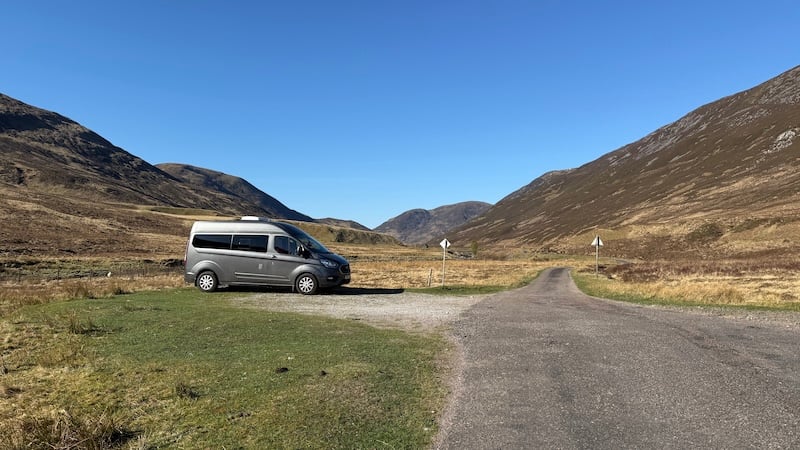
With a promising short weather window recently, I headed to Glen Roy in Lochaber with the aim of bagging all four Corbetts and two Fionas. I split the routes into three outings and, with two days available, I had an ambition to complete two routes on day one and the other route on day two. I slept in my campervan for two nights.
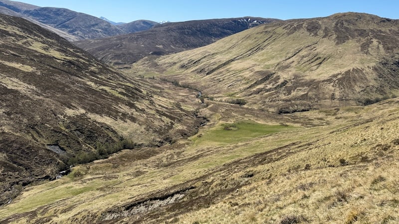
Although the distances of each route were not very long – between 10km and 16km – and the total ascent was less than 900m for each outing, the terrain is rough and not well trodden. I needed to climb steep heathery slopes, tramp over pathless ground and navigate my own routes. But the rewards in this glen are huge. It’s a peaceful and very beautiful location with stunning vistas.
I think that because there are no Munros in Glen Roy, it is much less frequented and during my hikes, I met no-one else. I saw only a few cars, a motorhome and a motorbike on the narrow, winding tarmac road through the glen over the two nights and two days.
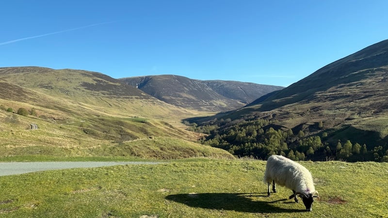
The remote-feel and views made me feel very happy. I also spotted an eagle and came face to face with a very green and very long lizard.
Of further interest, Glen Roy is home to the impressive “parallel roads”.
What are the parallel roads?
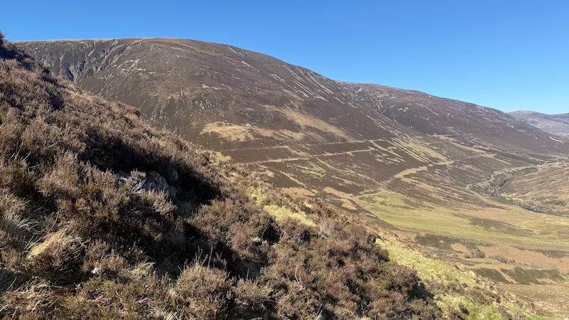
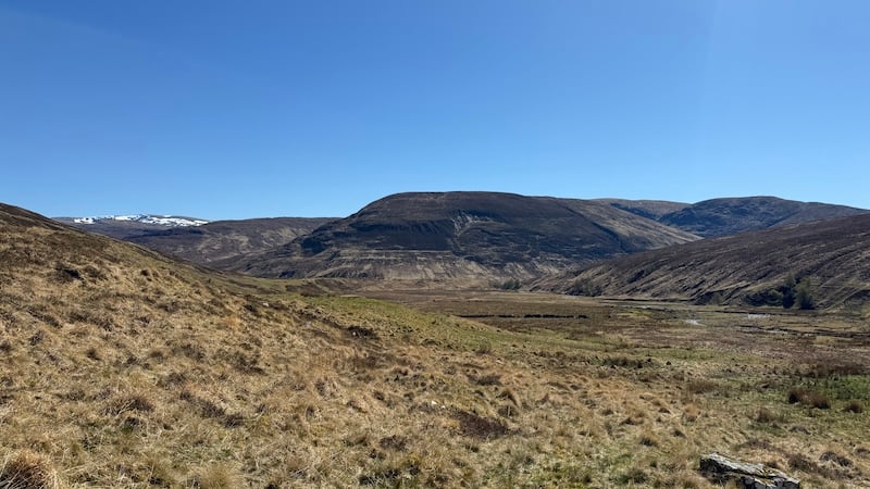
The Parallel Roads of Glen Roy are natural, horizontal terraces carved into the mountain sides. There are three distinct parallel lines that formerly formed shorelines of ice-dammed lakes. The shores were created some 10,000 to 13,000 years ago during the last Ice Age.
It’s easy to see the parallel roads from afar but, up close, they can be less distinct. I made a point of looking for the roads as I walked over them and noticed that, in some places, they form fairly wide terraces. Over the many centuries, though, some of the roads have morphed and sunken into the ground and become covered in vegetation so they are not so easy to make out when you are actually on them.
Walk 1: Corbetts both called Carn Dearg
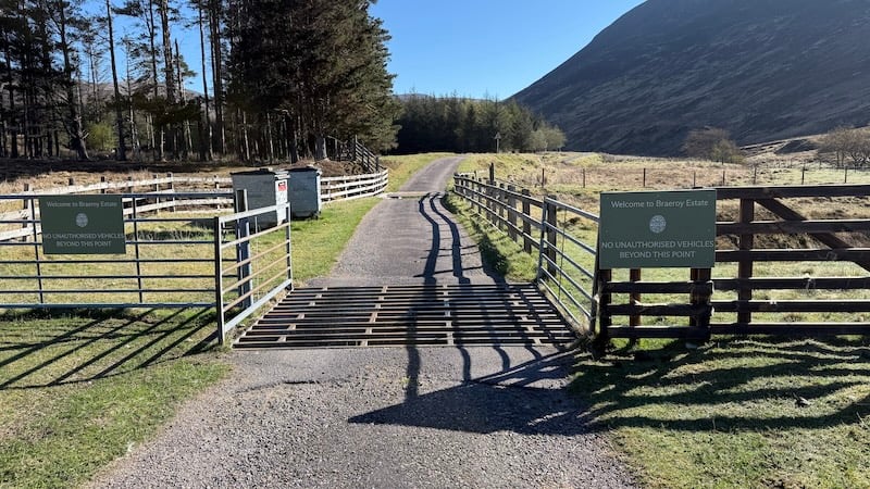
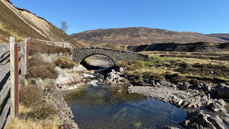
Carn Dearg is Gaelic for “red cairn”. In Glen Roy, there are three summits named Carn Dearg. My first route – the longest – took in two Carn Deargs. The walk started from the end of the tarmac road in the glen. There is a small parking area and a notice on a gate, before a cattle grid, to tell you that no unauthorised vehicles can proceed further.
The weather was warm and sunny and I was happy to swap the van for progress on foot.
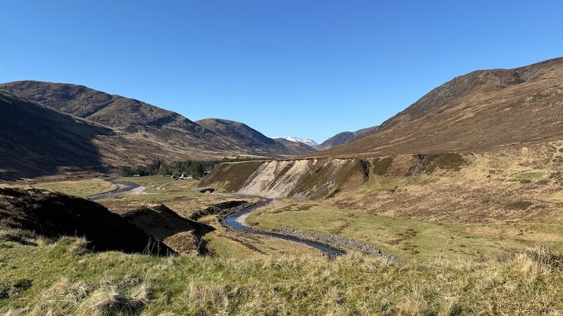
The flat track heads past a lodge and farm buildings before winding into Glen Turret. After crossing an old stone bridge, I decided to walk left with a plan to complete a clockwise loop, bagging the taller Carn Dearg at 817m first, then the second Carn Dearg at 768m.
This didn’t happen, however, because I ended up on the wrong side of a deep river gorge. I was enjoying the sunshine and the views too much and progressed through the glen on the right bank of the river.
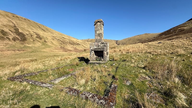
Coming to the end of a track, I followed a boggy path for a while. I passed a ruined building with a prominent chimney, still intact, and old walled sheep pens.
But instead of continuing along the path in the lower part of the glen and heading towards another chimney stack and a bridge across the river, I found myself ascending east, also on a path, but to the south side of the river.
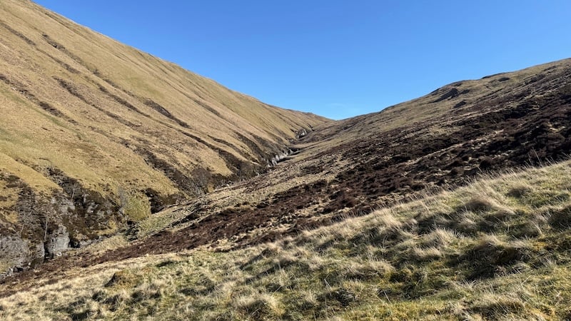
Usually, it’s possible to cross a river further along a glen, but not this time! Looking down on the ravine of Allt Eachach, I could see only steep, deep sides that looked pretty tricky to traverse.
So, I made a new plan. After consulting my map, I decided to stay on the south side of Allt Eachach and head more directly to the smaller Carn Dearg first.
The mountain slope was steep and covered in vegetation but I made fairly quick progress on fresh legs in an easterly direction. Overhead, an eagle swooped on high air thermals before I made it to my first summit of the day.
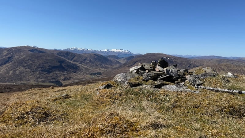
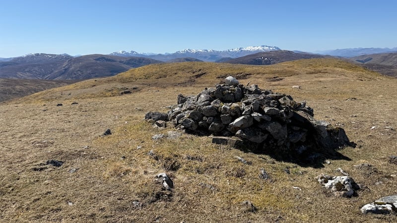
A small cairn sat at 768m elevation and I stopped for a quick bite to eat and to survey the wide vistas of mountains all around.
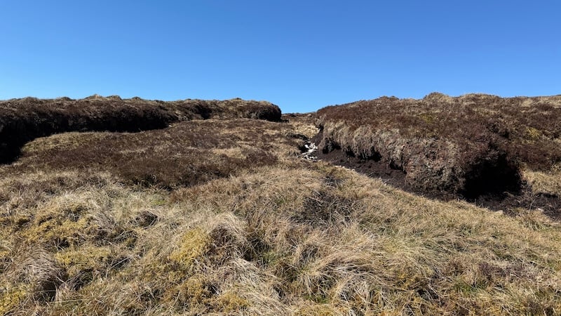
Looking to the north-west, I could see the second Carn Dearg. I headed directly downhill towards a bealach at some 570m elevation. I was now at the head of the gorge and so the waterway was (finally!) small and easy to cross. However, there are some fairly hefty peat hags at the bealach so it wasn’t a speedy traverse between the summits.
I progressed uphill in a northerly direction, passing the hump of Meallan Odhar to the right and on to the rocky summit of the second Carn Dearg, this time at a height of 817m. Again, the vistas were wonderful. Many mountains still held snow at higher altitude and the white of the snow offered a striking contrast with the blue sky.
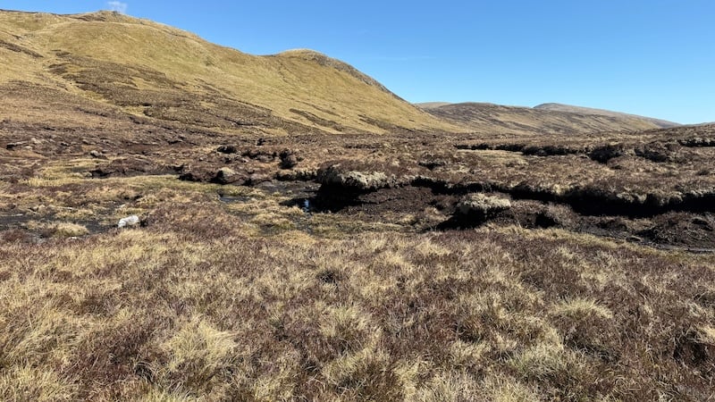
Again, I looked at the map to plan my route back to my van. I decided to strike off the summit in a south-westerly direction, heading down towards Teanga Mhor. On the way, I encountered more tall peat hags and had to weave in and out and around these, although thankfully they were quite dry.
My return route was the one that I’d originally planned to follow for the outward part of the walk. Some sections were very steep and I decided that I would not have enjoyed walking uphill. In the end, the route I walked turned out to be quite favourable.
I crossed the river lower down the slope and then picked up the path in Glen Turret and followed it back to the track, passing the farm and lodge house again, before returning to my van.
You can see my route below. It’s one of several possible route options and not necessarily the shortest but I enjoyed it overall.
2 Corbetts, Carn Dearg:
Distance: 16km
Total ascent: 870m
See the two other walks in Glen Roy
Also read: