Scottish walks have a habit of looking tidy on paper. A car park sits here. A summit sits there. The map shows a neat gap between them, and, for a moment, the day looks simple. Then the path curls round a forestry track, the hillside steepens, and the short-cut that looked tempting at home turns into a wet trudge through peat hags.
Distance still matters when planning a hill walk, a trail run, or a bike ride. It helps with planning for daylight, food, water, transport and whether the legs have another climb in them. But distance on its own is a blunt tool. A walk is rarely just the space between A and B.

The straight line is only the beginning
There is a simple sort of distance that most of us understand without thinking too hard about it: The line between two points. On a flat piece of paper, that line behaves nicely. Give each point a pair of coordinates, and the maths can tell you how far apart they are. It is the kind of calculation many people first encounter in school, with x and y-values plotted on a grid.
For walkers who like the map side of planning, Omni Calculator’s distance between two points calculator is a useful way to understand the straight-line distance formula behind simple grid measurements. It will not tell you the full length of a hill route, but it does show why the as-the-crow-flies distance between two points is only the start of outdoor planning.
A summit might be only a couple of kilometres from the start as the crow flies. Lovely. The actual path may loop around crags, cross a boggy bealach, lose height, regain it, then ask you to pick your way over loose stones near the top.
The map has not lied. The straight line simply did not tell the whole story.
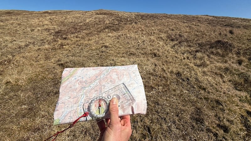
Maps are full of useful clues
A good map is a quiet warning system. Contours tell you when a short distance is going to bite. Paths show where people have found a sensible line through the ground. Rivers, forestry, cliffs, and fences add more clues.
Grid references add another layer. The Ordnance Survey’s Map Reading Made Easy guide explains the basics of eastings and northings, which help pinpoint a location on a map. That grid language is closer to coordinates than a postcode or place name.
Still, a grid reference is no guarantee of easy walking.
Anyone who has crossed wet moorland knows the feeling. The destination does not seem far away, but every step has to negotiate tussocks, peat hags and hidden water.

Route distance has a personality
Two walks can have the same mileage and feel completely different. A flat 10km along a canal towpath near Glasgow is not the same as 10km over a rough Highland hill. One lets the mind drift. The other keeps asking questions. Where is the next cairn? Is that the path or a sheep track?
Height gain makes the difference obvious, but surface matters too. A stony track, forest path, muddy field edge, snow slope and heather-covered hillside all have their own pace.
Weather changes the calculation again. A dry evening on a familiar path is one thing. The same path in clag, wind and sideways rain is a different walk. Suddenly, distance has company: visibility, temperature, navigation, tiredness and the mood of everyone in the group.
That is why rough planning needs more than one number.
A better way to think about outdoor distance
The useful question is not only: How far is it?
A better version might be: What sort of distance is it?
Is it a path all the way, or a line across open ground? Does the route climb steadily or throw in short, sharp pulls? Is there a simple escape route if the weather turns? Will the last few kilometres happen in daylight?
There is no need to make every walk feel like an expedition. Most half-day routes close to towns are straightforward, and we have shared plenty of practical ideas in our guide to favourite half-day walks close to Glasgow.
Even then, small checks are worth doing. A short walk can still have a steep pull. A local hill can still catch clouds. A route that looks close to the city can still involve an awkward return to the start.
The numbers help. The ground gets the final say.
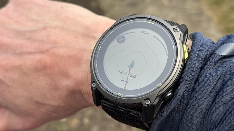
Apps, watches and old-fashioned judgement
Outdoor technology has made planning easier.
A GPS watch records distance. A phone map app shows a line on the map. Online route tools estimate mileage and height gain. A coordinate calculator explains the neat maths behind two points on a grid.
The trouble starts when one tool becomes the whole plan. Batteries fade. Signals drop. Screens get wet. A route line can look confident while the ground underneath it is anything but. Our post on the free beginner’s guide to navigation by Ramblers Scotland is a useful reminder that map reading, compass basics and phone navigation all belong in the same conversation.
A watch might say 7km. The map might show a steep pull between contour lines. The sky might suggest waterproofs before lunch.
Believe all three.
The sensible answer is usually a mix
Straight-line distance has a place in outdoor thinking. It helps explain scale and shows the difference between direct distance and walked distance. A summit can sit nearby and still require a looping approach. A loch or private land boundary may turn a short-looking line into a much longer day.
The straight line is not wrong. It is just quiet about the awkward bits.
The best outdoor planning tends to be a mixture of simple maths and muddy realism.
Check the route distance. Read the contours. Think about the surface underfoot. Check the weather. Leave time for snacks, faffing, photos, layers, tired legs and the bus that only runs when it feels like it.
A walk is never only the distance between two points. Sometimes that is exactly what makes it worth doing.