This is a walking route of stunning contrasts and spectacular views on the Coigach peninsula, north of Ullapool. While I had previously walked to the summits of both Fionas, Ben More Coigach and Sgurr an Fhidhleir, from the east at Blughasary (longer walk, shorter drive to the start), I had not completed the classic circuit from near Achiltibuie, which includes a fine ridge. Hubby G has long been keen to walk this route, too, because, he told me: “I’d often seen this amazing ridge when driving the road north of Ullapool but I didn’t know what it was.”

Getting to the start of Ben More Coigach and Sgurr an Fhidhleir circuit
The start of the circuit is south of Achiltibuie and just before Culnacraig. It’s a long drive on a singletrack road, leaving the main Ullapool road at Drumrunie to drive around the peninsula. The start of the walk is at the end of the narrow road, but parking is a few hundred metres earlier in a large lay-by space that can accommodate around five vehicles.
Walk to first summit
After parking the car, we walked to the end of the road, and on to a track passing a couple of houses to the south and then followed a fence line south-west. Our plan was to complete the loop in an anti-clockwise direction, climbing up to the first summit, Ben More Coigach, via the ridge.
A path leaves the line of the fence and is mostly obvious. The route is across open moorland that is quite boggy in places. After around 1km or so, a path starts to wind uphill and never really stops.
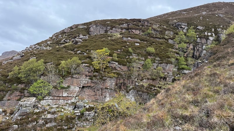
The first section of the climb is on the south side of Allt nan Coisiche, which forms a deep stone-and-slab-sided ravine. It is a dramatic view to your left as you ascend.
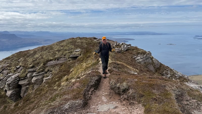
The path heads around and through rocks on a steep section that climbs from 150m to 350m elevation in an easterly direction. I enjoyed pushing myself a bit on this and I played cat-and-mouse with another walker. Hubby G was enjoying his own pace for the first part of the uphill before we came back together to cross a flatter section of vegetation covered ground.
We could see the large rocky lump of Garbh Choireachan ahead and made our way across to the lower section of this, mostly following a trod or a path.
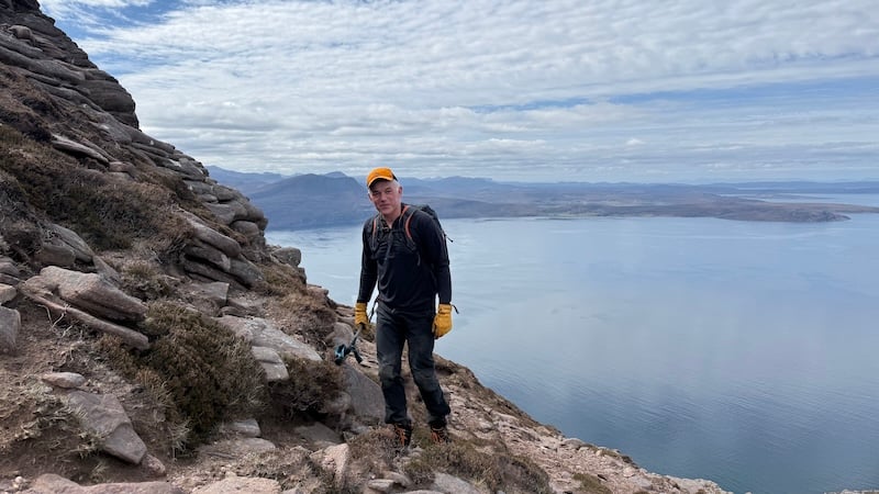
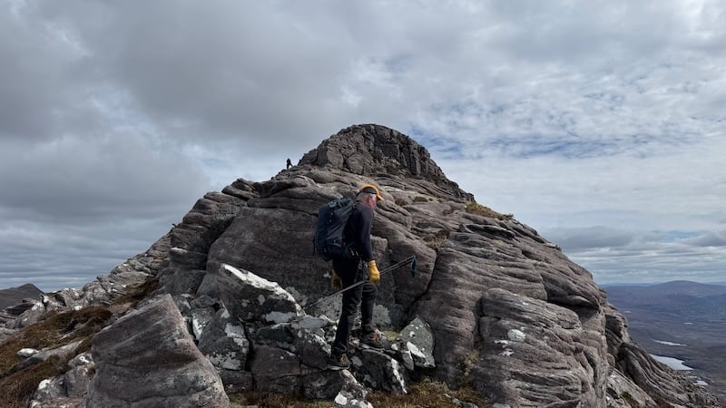
Our aim for the first part of the rocky climb was a steep, grassy chute with a little scrambling at the top. From here, we followed a network of paths along the ridge, which headed east-east-north.
There are options to bypass the very top of the ridge by sticking to a lower path that follows the north side of the ridge. This is not a particularly precipitous ridge, by northern Scotland standards, but it’s still important to tread carefully to avoid tripping or slipping.
The drops are steep and if you are nervous of heights I recommend you look ahead or up to your right as a focus point.
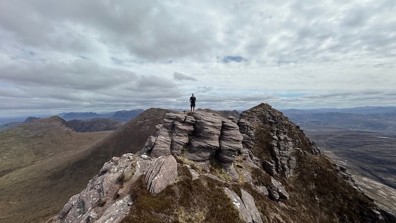
Where I could, I enjoyed scrambling up to the very top of the ridge and walking along with care. The views are by far the best from the ridgeline and while I am not great with exposure, I was fine on this fairly wide ridge.
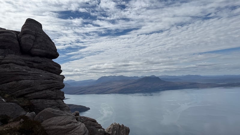
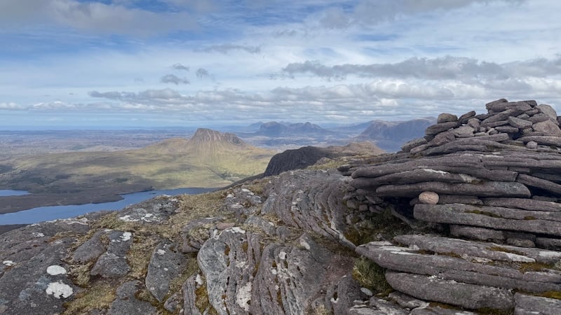
The high point on the ridge is around 740m, about half-way along, before it descends a bit and then the path curves north-west and then more westerly to reach Ben More Coigach summit at 743m elevation.
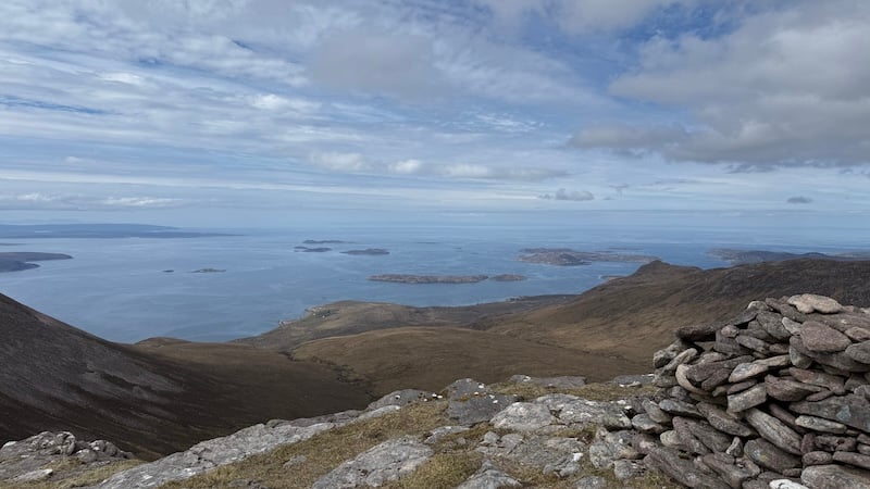
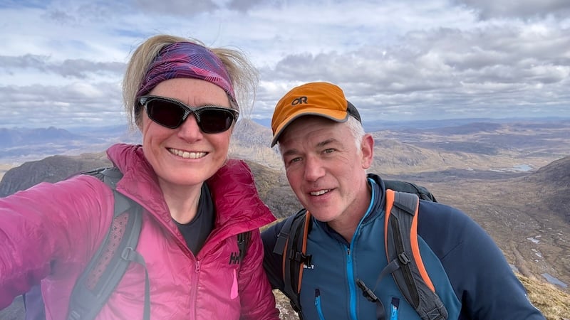
There is a shelter and a cairn and it’s worth stopping for a while to enjoy the fabulous viewpoint. To the south and west is Loch Broom and the open sea, which is dotted with islands (collectively the Summer Isles). Looking north, the many peaks of Assynt are laid out. Hubby G and I enjoyed naming them all. Assynt is one of my favourite areas of Scotland and the scenery is superb.
Ben More Coigach and Sgurr an Fhidhleir
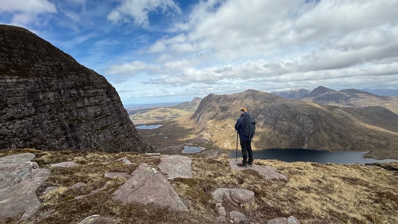
After stopping for a picnic lunch, we started the next section of the walk, descending north to a bealach between BMC and the fin-like shape of Sgurr an Fhidhleir. The drop was around 200m on a wide and high plateau area.
In poor weather, you will need to take care because there is a steep drop off to the north and east. In contrast to the rocky ridge before, this area of the mountain is wider, flatter and much grassier.
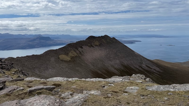
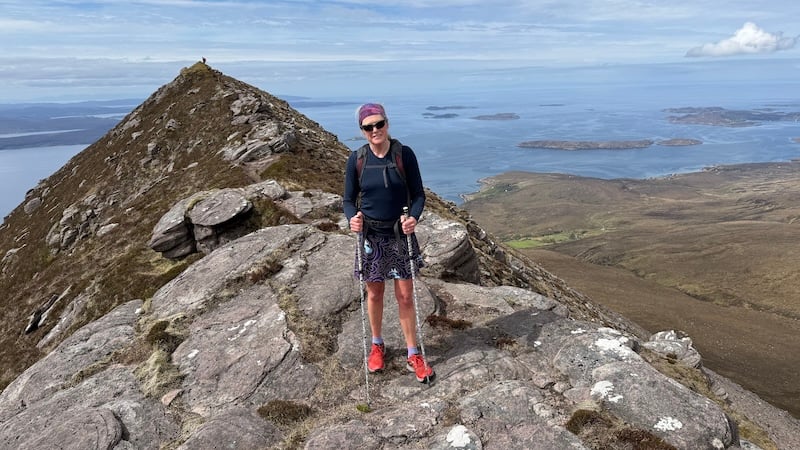
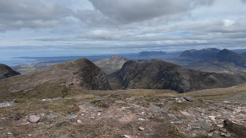
The triangular back of Sgurr an Fhidhleir rose up ahead to the north and while it had looked rather steep from afar, once we closed in on it, it was much more benign.
Without much of a trod to follow at the start, G and I made our own routes up the wide flank before coming together higher up on a more obvious path.
The viewpoint on Sgurr an Fhidhleir at 704m elevation is even more impressive than BMC. We stood and gazed in awe at the numerous mountains of Assynt layered in front of us.
In my opinion, you should only do this route on a fine weather day because otherwise you will miss the incredible views.
If you have never seen or visited Assynt, let me describe it to you as best I can. You can also see my photos.
The landscape and geology of Assynt is seemingly otherworldly. Stunning mountains rise dramatically like individual islands made Torridonian sandstone from cnoc and lochan moorland. The area is a maze of grassy moors, lochans (tiny lakes) and iconic mountains, such as Stac Pollaidh and Suilven, all edged by a rugged, indented coastline.
Looking over our shoulders, we could also spot the outline of the Outer Hebridean islands across the North Minch, the Summer Isles in the near distance and the long, irregular coastline of north-west Scotland to the south.
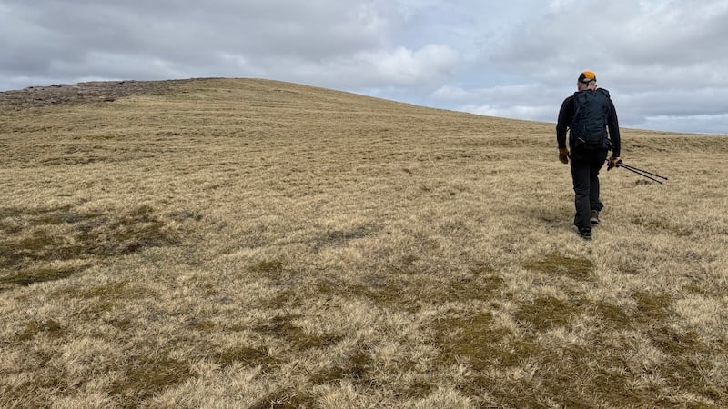
The final descent took us south-west over rough moorland. We eventually picked up a path that tracked a route almost mid-distance between Allt a’ Choire Reidh to the north and Allt nan Coisiche to the south. The descent gradient was quite gentle at the beginning before steepening in the final kilometre.
We headed back along the tarmac road (uphill!) to reach the car again.
The distance is around 10.5km and with some 950m of ascent and one of the best routes to recommend in Scotland.