Spotting a window of good weather last week, I made an early start to walk two Corbetts, Meall na h-Èilde and Geal Charn, as well as the Fiona Glas Bheinn, near Loch Arkaig. While the route starts and finishes on a wide track, there were no paths and only a few sections of trod to be found on the mountains. However, the terrain was surprisingly good and I made quite speedy progress to complete a 17km route with some 1480m of total ascent.
To get to the start
I drove south on the A82 from Inverness to reach the Commando Memorial, near Spean Bridge. Turning right off the main road, I followed the singletrack tarmac road (B8004) through Gairlochy, over a bridge across the Caledonian Canal and right along the B8005 and a section of north-western shore of Loch Lochy.
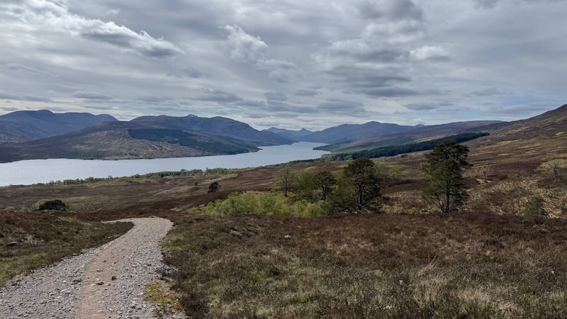
I turned left at Clunes, driving along the northern shore of Loch Arkaig. I have driven the full length of Arkaig several times before and it is a very long and winding road so I was thankful that my targeted mountains were only a few miles along, starting near Achnasaul.
Parking note: There is a forestry area at Achnasaul, where you might normally expect to park, but there is felling work on-going and signs request that you avoid parking here. Instead, I drove further west along the road and over a bridge just past the start of the walking route. On the right, just off the road, there was a fairly large area of verge that could accommodate a few vehicles and still retain a passing place for traffic. Careful parking here should be fine.
Walk to the first summit on Glas Bheinn
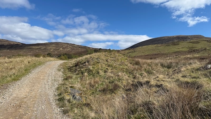
Having parked, I walked north-east back along the road and crossed the bridge over the Allt Dubh before turning immediately left on to a wide Landrover track. I passed through two metal gates and continued uphill on the track. It’s steep and rubbly in places but offered a good start (and finish) to the route.
My aim was to find a suitable place to head off the track to my right and on to open moorland to start the climb to Glas Bheinn. I knew it was unlikely there would be much of a path or trod so I looked for a section of mountain slope that wasn’t too steep or heather covered.
I ended up walking a couple of kilometres on the track before veering off and while I was expecting a difficult stomp over deep vegetation – similar to my Glen Roy experience recently – I was pleasantly surprised. The lower slope of heather turned into much shorter vegetation and then to an easier going ground of shorter grass and moss.
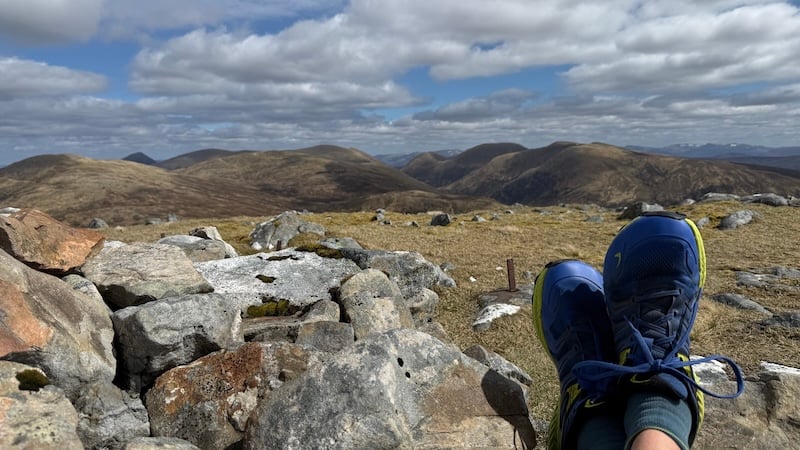
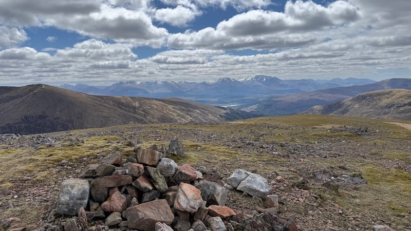
There were a few false crests to get over but it seemed that in no time I was striding out towards the summit of the Fiona, Glas Bheinn. The 732m top is marked with a cairn and the total ascent was almost 700m.
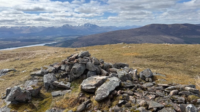
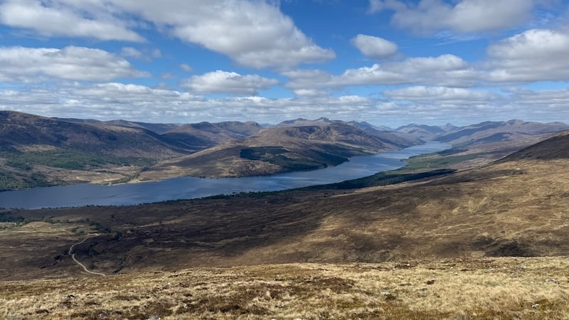
Despite a cold wind, I enjoyed many sunny spells and visibility was particularly good, which meant I could survey numerous mountain peaks in Lochaber. The north face of Ben Nevis was easy to see, still flanked in snow, to the south, and also the stunning Grey Corries, as well as the Loch Lochy Munros and Corbett Ben Tee to the north-east and further afield to the peaks of the Monadhliath. I sat for a while at the cairn to enjoy the full vista and a bite to eat.
On to Meall na h-Èilde
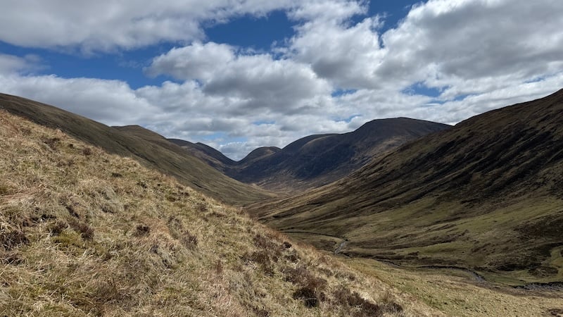
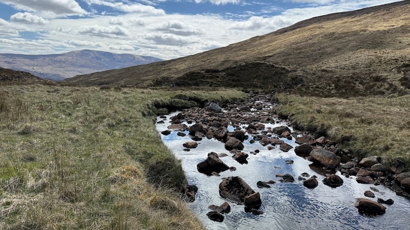
I descended to the north from the summit of Glas Bheinn, over Coire na Cosaig with its steep, craggy drop to the east and down to Gleann Tarsuinn. In doing so, I lost around 300m of height. Crossing the Allt Tarsuinn, I made my way uphill again, rising north-easterly. The first section of slope was rough and quite steep, but this soon eased and I walked up a gentler incline on fairly easy-going ground cover.
The Corbetts and Fionas are often rough and rugged with thick vegetation so it felt joyful to be on relatively easier grassy terrain. Higher up, I picked up a bit of a trod and I was soon heading towards the summit of the Corbett. I encountered a few peat hags here and there but nothing too annoying.
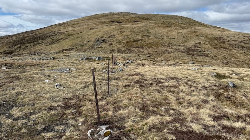
Just before the 838m summit of Meall na h-Èilde, and a cairn, I spotted a line of fence posts, which I already knew would be very helpful on the next part of the walk. Having earlier checked the map, I could see the old fence posts would serve as a useful “handrail”. While the visibility was excellent, it’s always good to have a bit of guidance in the mountains.
A second Corbett, Geal Chàrn
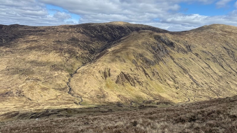
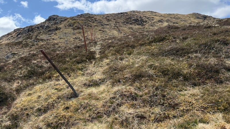
The fence line also had the outline of a trod next to it, which was useful when descending the first rock-strewn section in a northwesterly direction towards Bealach Choire ‘ Ghuirein. This short drop was around 100m before starting a climb back upwards to the next high point of Meall Coire nan Saobhaidh.
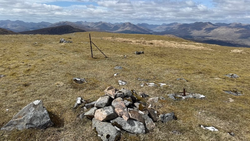
Again, the terrain was fairly good apart from a few patches of boulders and some heather, both of which were easy enough to skirt around and weave through. I passed a couple of small lochans on the grassy shoulder of Meall Coire nan Saobhaidh before gaining a cairn on the 826m summit, which is only 12m lower than the earlier Corbett.
I stayed with the fence line and descended again on a gentler gradient to the south-west and on towards Bealach Càrn na h-Urchaire. The ground was heathery and I passed a few small lochans.
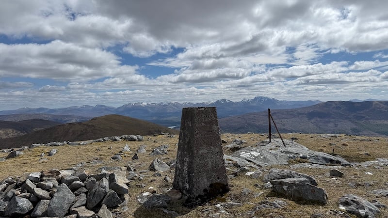
The final climb was steeper, although nothing too challenging and I enjoyed a fairly obvious trod for most of this section. Geal Chàrn rises ruggedly to 804m elevation, with a trig pillar atop. I stopped for more food and relished another superb viewpoint.
At this point, there was an option to continue on to another Fiona, Sgùrr Choinnich, to the west but I had a prior appointment that evening and I decided to leave this summit for another day.
- Check out Steven Fallon’s excellent website to see his route of the two Corbetts and two Fionas.
In any case, my day ended up being 17km and close to 1500m of ascent, which I was happy with.
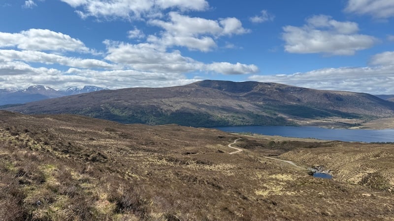
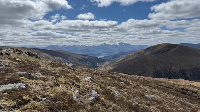
I headed directly south from Geal Chàrn and downhill. I was drawn to a trod and a lower summit, Beinn Mheadhoin, but there was no need to go as far as this point. Instead, I diverted south-east and across some rough ground with boggy patches and peat hags towards the Allt Dubh lower in the glen.
I picked up a path to the east side of the river (you need to climb up again a little way to get on to the path). This path headed south and then joined the wide track again, close to a small hydro dam.
I was quite swift on the descent once I reached the rough Landrover track, again enjoying the views of distance, snow-covered mountains.
Passing back through the two gates lower down the track, I regained the tarmac road and strolled back to my parked van.
I recommend you choose a day of good weather to walk these mountains, mainly because the views are so beautiful.