The four Munros that lie to the west of Tyndrum, in Strath Fillan, and to the south-east of Glen Lochy are frequently split into pairs by Munro baggers. Ben Oss and Beinn Dubhchraig can be walked in a day from Tyndrum or Dalrigh, while another day’s hike from Glen Lochy gives a shorter route to reach Ben Lui and Beinn a’Chleibh.
It’s also possible to walk the latter two from Tyndrum as I did many years ago. On Sunday, I decided to tackle all four Munros in one A-to-B traverse, starting at Dalrigh and finishing at a parking area off the A85 in Glen Lochy.
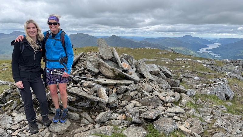
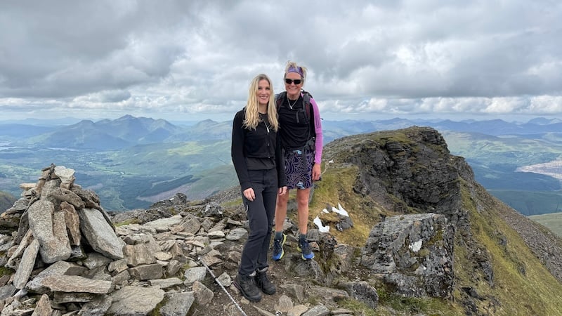
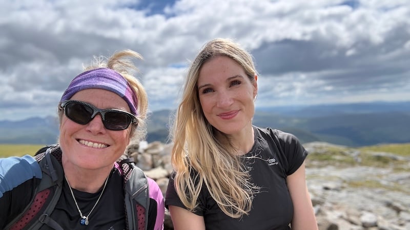
I was joined by my friend Sarah – the grown-up daughter of my ex-husband – for the day and having two vehicles allowed us to drop one at the start and another at the finish.
Traverse start at Dalrigh
From Dalrigh, there were two options to reach the summit of our first chosen Munro, Beinn Dubhchraig. While WalkHighlands suggests a route via Coille Coire Chuilc and ascending the north-east shoulder of Beinn Dubhchraig, an alternative is given by Steven Fallon on his website, Starting at Tyndrum or Dalrigh and heading on a track further west to reach Cononish, before then taking a more directly south route up Beinn Dubhchraig.
Despite reading about the “boggy path”, I went for the more direct route as suggested by WalkHighlands. I can confirm it is wet and boggy and we had to do a few detours around the boggiest sections. In retrospect, however, it was not as deeply boggy as the descent route from Ben Lui later in the day.
One reason for the more direct route was I knew there would be an obvious path. I had not seen Sarah for a while and I expected we would have a lot to chat about, so a path made sense because it would be easier to navigate. Chatting and map reading do not make easy companions.
Even so, we did make a small error on reaching the West Highland Way early in the walk. Instead of crossing the WHW to continue uphill, we turned on to the trail. We easily corrected this and found the proper path uphill.
I’ve known Sarah since she was a young teenager and we don’t get to meet up as frequently as we would like, so when we do, we always have a lot to talk about. As we talked and laughed, we made relatively easy work of the first ascent, walking south-westerly towards the bealach between Beinn Dubhchraig and Ben Oss.
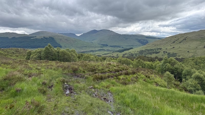
Once past the trees and most of the bog we found ourselves in more open moorland. The views became more expansive looking out across the southern Highlands. The weather was warm but not too sunny thanks to high clouds.
The higher slopes became a bit steeper but there was a path all the way.
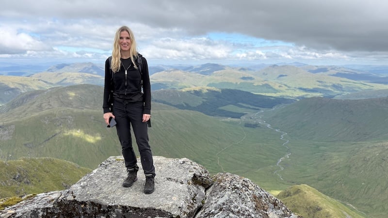
From the bealach, there was another short pull uphill, this time in a south-easterly direction, before a flatter section along the ridge to the top. The first Munro is 978m tall and, having started at round 175m elevation, it meant to first ascent totalled some 800m.
Beinn Dubhchraig to Ben Oss
We had a quick snack and then retraced our steps to the bealach. It was easy to see Ben Oss ahead and to the west, with its higher summit of 1029m. Between Dubhchraig and Oss, the path dropped to about 780m, which meant there was not a lot of descending and reascending.
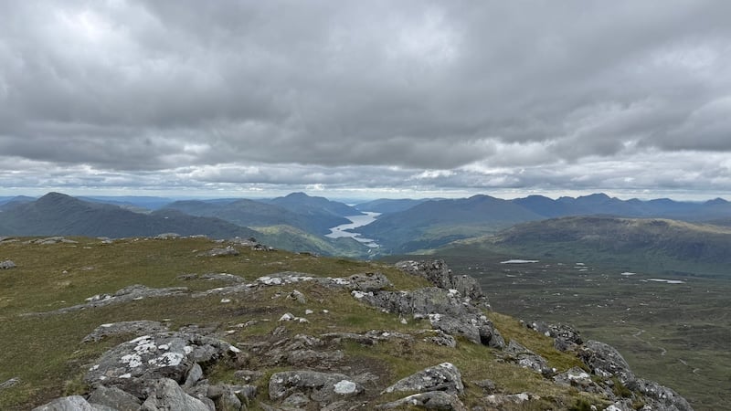
Looking south, in the near distance was beautiful Loch Oss but it was the wider vistas that we most enjoyed. All around, peak after peak was played out before us and as far as the eye could see.
It felt like no time at all before we were perched atop Ben Oss. We met a couple of men who had been considering an alternative descent from Oss back to Dalrigh to avoid the boggy forest path. We later saw them descending the steep slopes of Coire Laoigh, headed for a track along the lower glen and past Cononish. (I mentioned this earlier as a very viable alternative.)
Ben Oss to Ben Lui
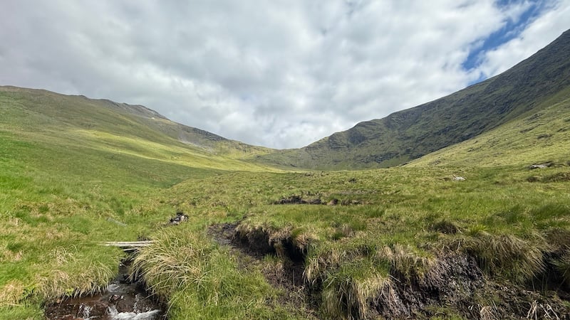
Sarah and I headed off Ben Oss summit in a southerly direction. There were bits and pieces of trod before we picked up a more obvious path heading down Creag Dhubh a’ Bhealaich, weaving in and out of rocks and thick grass.
Our route curved west as we descended to around 680m before another fairly steep uphill travelling north-westerly. Our chat continued and the sun shone strongly on and off.
We both talked about how much we enjoy the freedom of being the mountains. I find hiking mentally uplifting and while it can be hard physically at times, the rewards always outweigh the exertion.
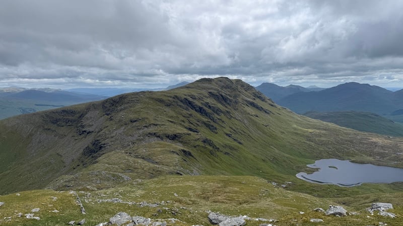
The easterly slopes of Ben Lui plummet into the corrie. It’s an area popular with climbers although we didn’t spot any.
Ben Lui is also a National Nature Reserve, acclaimed for its rich alpine flora, which includes rare montane willows, saxifrages and unique lichens
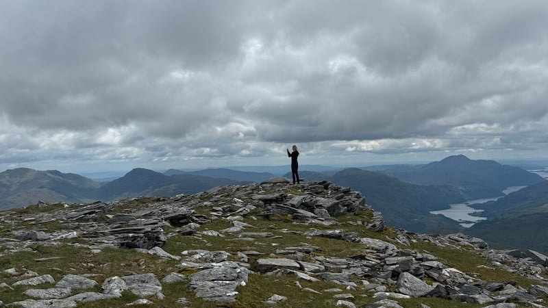
The third Munro in our route was the tallest at 1130m. By now, I was starting to feel the effort of the ascents in my legs but we had covered a large chunk of the traverse by now so my feelings were satisfaction rather than exhaustion.
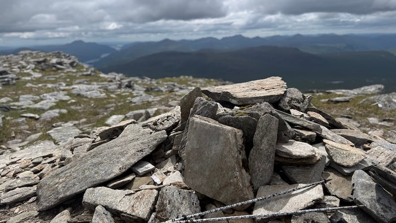
A cairn marked the summit and we stopped for a bite to eat. Looking west, we could see the final Munro below us.
Benn Lui to Beinn a’Chleibh
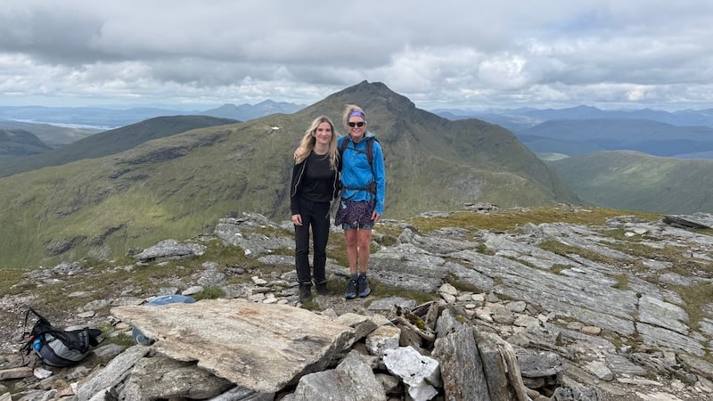
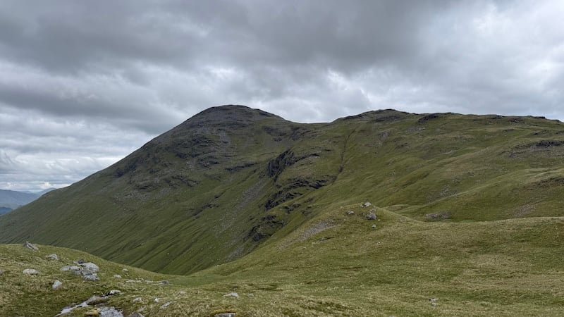
Beinn a’Chleibh can only just claim the title of a Munro. Its summit is two metres above the 914m requirement and it looked like a very easy route to reach from Ben Lui.
Of course, there was still a down and an up to negotiate. The route dropped to around 780m before another push up to the summit.
There was a very obvious path to follow and I hardly needed to consult the map, except to make sure we descended the right side of Lui.
The final Munro required an “out and back” section. After reaching the summit, we retraced our steps to Fionn Choirein, where we easily picked up a descent path.
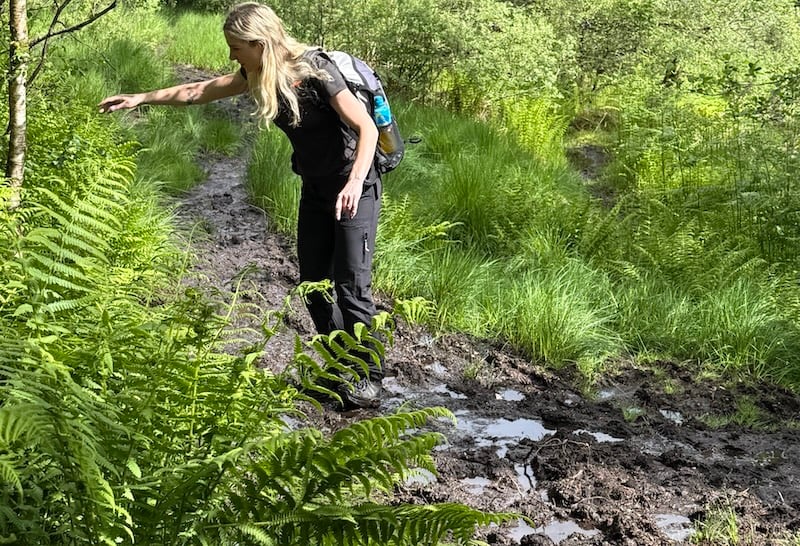
The route zig-zagged downhill through a beautiful corrie before heading into forest land. We had been warned about the boggy ground lower down the slope but we were convinced it wouldn’t be too bad. After all, we had faced boggy paths on the first ascent path. But, oh my goodness, it was bad!
I remember this path from previous walks of Ben Lui but I don’t think the gloopy wet and bog was ever as bad as we encountered. Many times, my foot went deep into the bog or we had to try to jump, avoid or detour very, very boggy ground.
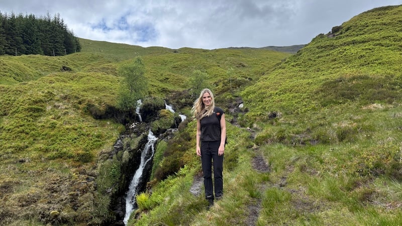
Alongside our slippery, messy descent, there was a gorgeous burbling burn and some lovely waterfalls. The shade from the trees was also welcomed as the air had became hotter and closer at lower elevation.
Sarah and I made the best of the situation and laughed about the extent of the bog, hoping it would be over quite soon.
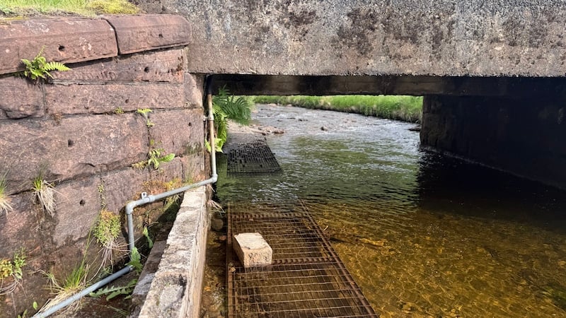
Eventually, we reached a firmer path that led us to the edge of the trees. We then negotiated – ie ducked very low – through a small underpass, below the railway, before a river crossing.
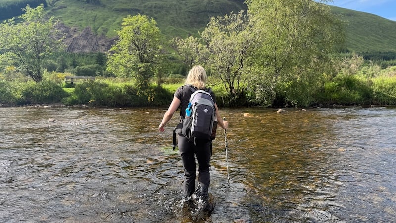
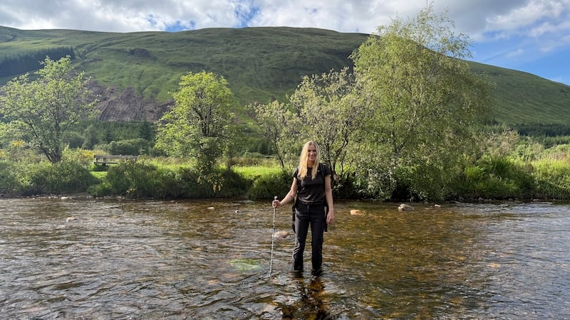
Again, we had been warned by other walkers about a wide river crossing. People told us they had waded through in bare feet, but we decided to embrace the opportunity to give our footwear a wash and we walked across without shoes on. We had a hiking pole each for balance on the slippery rocks but it was actually quite easy. I enjoyed the cooling effect of the cold water on my feet, too.
The last short section of the traverse route led us along a track and back to the car park beside the main road where we had earlier left Sarah’s car.
We had both thoroughly enjoyed the route – and walking it together. I was also pleased with how I navigated the route. As we said goodbye, we made a promise to meet again this summer for another mountain hike.
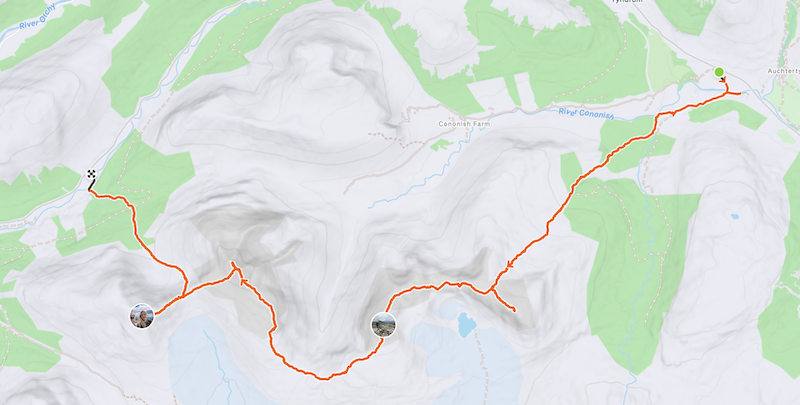
The details: Beinn Dubhchraig, Ben Oss, Ben Lui and Beinn a’Chleibh
The total distance was around 21km with an overall ascent of 1769m. It took us eight hours and a moving time of six hours 40 minutes.