My dedication to some of Scotland’s lesser known mountains has taken me to new places recently, including Glenartney in western Perthshire. My goal was a couple of Fionas, Beinn Dearg and Mor Bheinn, on the north side of the singletrack glen road, which winds south-west from the village of Comrie.
Arriving on a Friday, mid-morning, I had been hoping for better conditions than was forecast but, as I stepped out of my van, parked at Glenartney Church, I was met with a brisk wind and very damp air. Looking up to where the summits should be, I could see only cloud.
Of course, I wondered if it would be better just to drive on and leave these mountains for another day but ever the optimist I decided to trust in the Met Office report, which had indicated the weather would improve throughout the day.
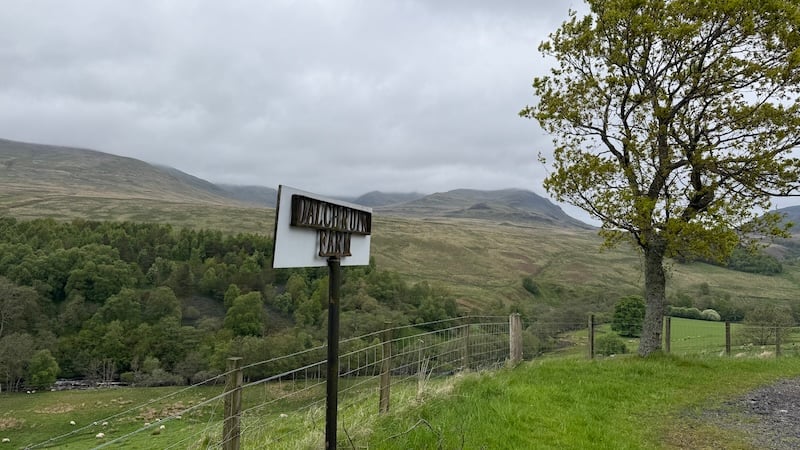
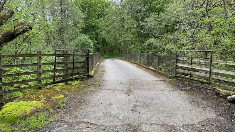
From the car park, I walked back along the road east and then turned left on to a rough track signposted as Dalchruin Farm. The track descended past a few houses and through a rather eerie (abandoned?) set of farm buildings. Perhaps it was the weather, or my mood, but I felt a shiver of bad vibes. This is an unusual feeling for me and, thankfully, this sense of unease left me soon after when the track took me alongside a pretty river and then over a wooden bridge and towards the hills.
I made a small error, walking a short way along the wrong track towards Dalcathick Lodge and then corrected myself and took the next turning, through an open metal gate, heading north-west.
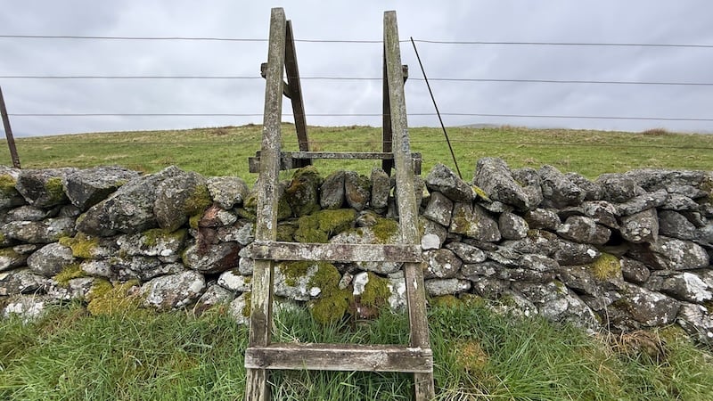
A faint trod came and went as I crossed wet and boggy fields, charting a route west and towards the lower slopes of my first Fiona, Beinn Dearg. I crossed a wall by way of a wooden stile and continued in the direction of my target, the shoulder at Sron na Maoile.
A wet and cloudy ascent
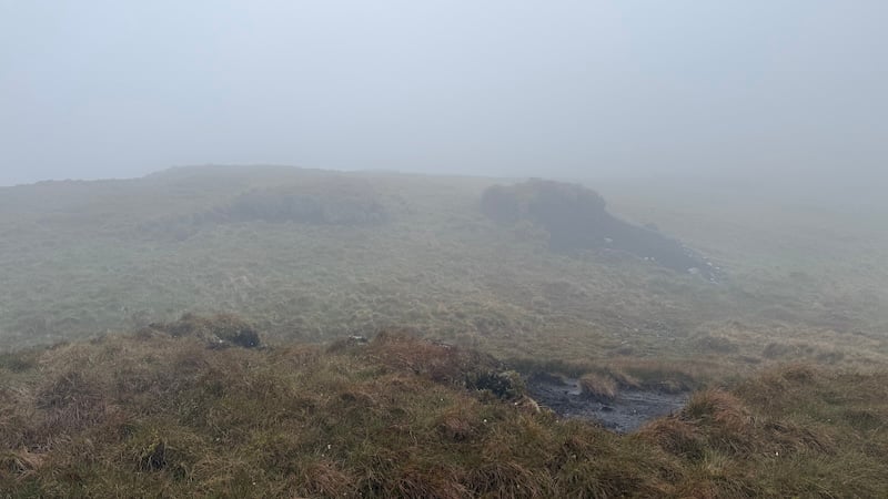
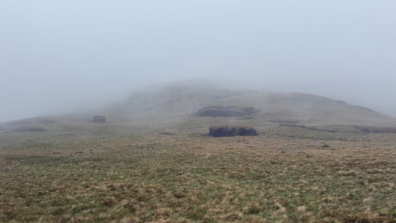
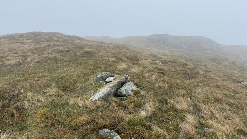
At first the slope was fairly steep and tussocky, so my pace slowed. Then, from around 400m elevation, I walked into the clouds and it started to drizzle. The wind picked up and I wondered to myself what on earth I was doing. I thought that maybe I should turn around and return to the van instead of pushing on into increasingly miserable conditions.
But then I reminded myself that I could be sat at my desk instead of being outdoors and, in any case, poor visibility means navigation practice, which I enjoy.
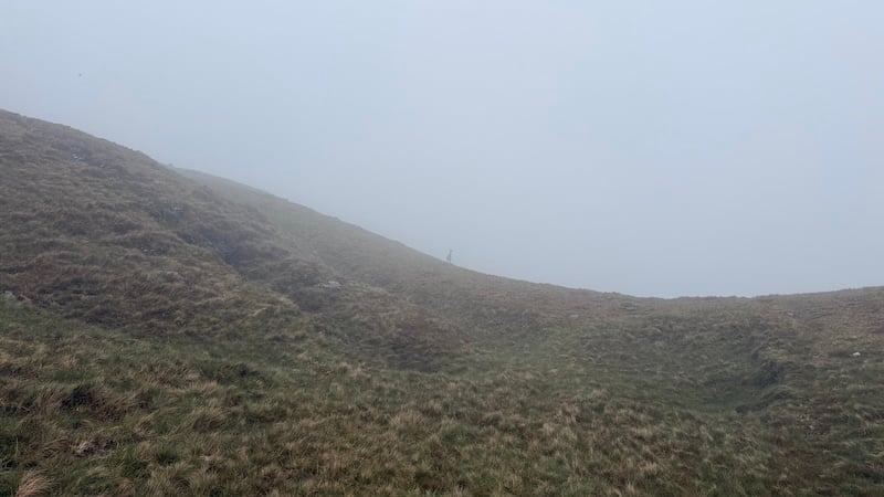
So on I went, ascending into a white-out of cloud and with the rain soaking my clothing and splattering my glasses. I pulled my waterproof jacket hood closer around my head to keep off the rain and stop the wind buffeting my ears.
I also took care to keep track of my direction using a map and compass, as well as my OS Map app. It can feel very disorientating when walking in cloud because it is hard to judge distance and gradients.
From Sron na Maoile, I adjusted my direction a little more to the north and then walked on to a flatter section at around 600m altitude. More careful navigation – and some huge peat hag dodging! – took me up to Sron nam Broighleag at 679m and then a gentler gradient to Creag na h-Eararuidh.
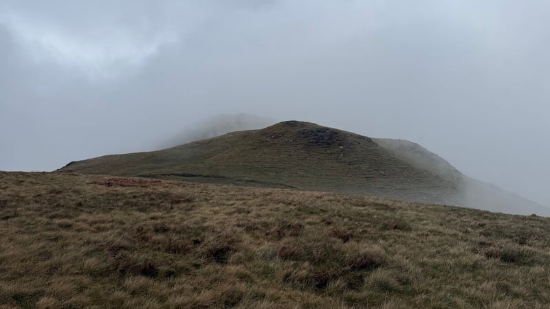
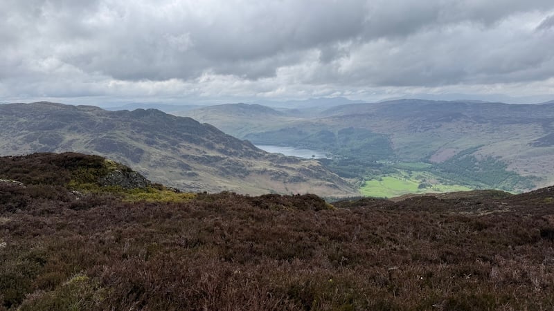
Thankfully, the improving forecast was coming true with the clouds starting to shift and dissipate. Every so often, I was given a much clearer picture of the landscape ahead until the clouds fully lifted and I could see the full beauty of this glen in every direction. I stood for a while at intervals to take in the superb spectacle.
A herd of red deer eyed me nervously, standing still to take stock of my presence before then running off behind a large lump of land.
A height anomaly
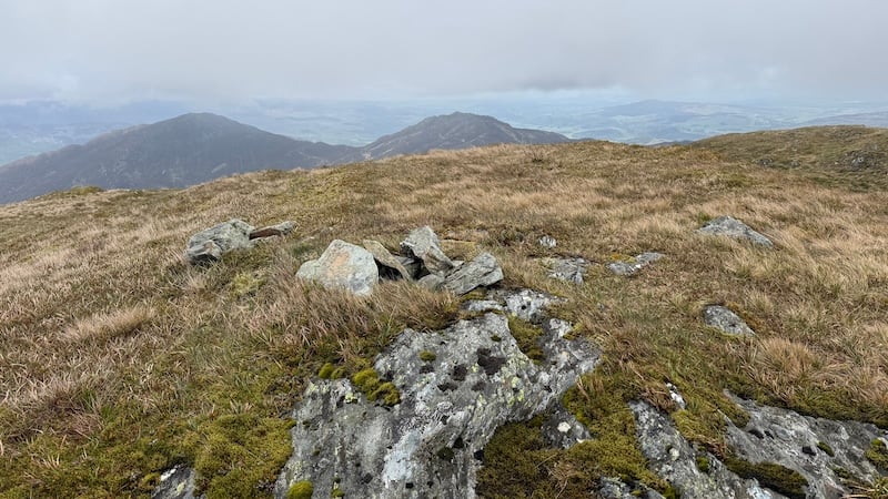
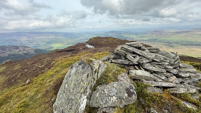
If you are a keen bagger, it’s worth noting that while Beinn Dearg is named as the Fiona (or Graham), it is a metre shy of a higher point, some 2km further south-west. It didn’t really matter to me because my route took me fully along the undulating ridge and over the highest point at 708m, Creag na h-Eararuidh, before reaching Beinn Dearg. Both points feature small cairns.
With a much clearer sky, I could now easily see the rest of my planned route to the north-east on a pair of neighbouring heather-covered summits. There are some vast peat hags on this mountain and I spent time going round them where I could, or down and through them, where feasible.
Beinn Dearg to Mor Bheinn
From the summit of Beinn Dearg, I made sure to walk north to avoid the steep and craggy ground to the east. A few hundred metres on, I then tracked north-east and started a descent on a narrower shoulder of tussocky ground to a height around just 300m. There were some trods here that made navigating a little easier, although I was still cautious to ensure I didn’t drop off above a big crag.
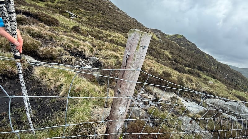
There was a lot of talk of fences in the glen, especially a high deer fence, when I was reading about this route and I did need to do a bit of climbing. I was grateful for a high wooden stile and also a wooden ladder section in the tall wire fence.
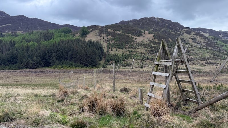
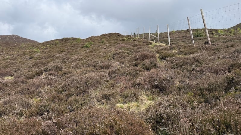
Once I had negotiated the deer fence, I then used the line of another lower fence as a handrail. The fence took me directly east for the next part of the route. Keeping fairly tight to this fence I was able to ascend a steep slope and skirt the edge of thick woodland.
The ground was either wet and boggy or covered grass clumps and heather so the going felt quite tough but I made quick progress of the next 300m of ascent.
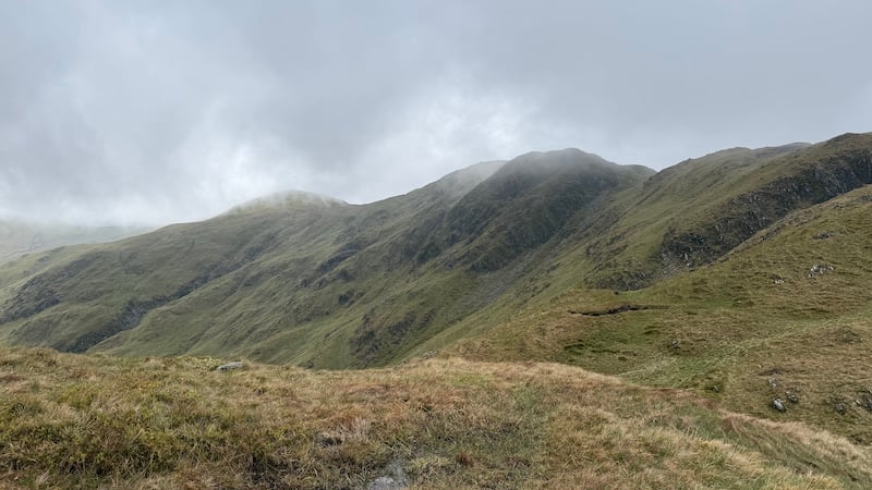
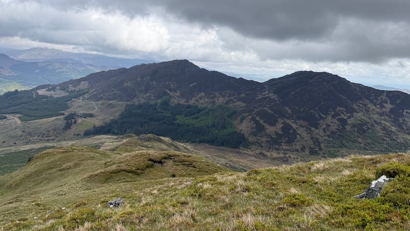
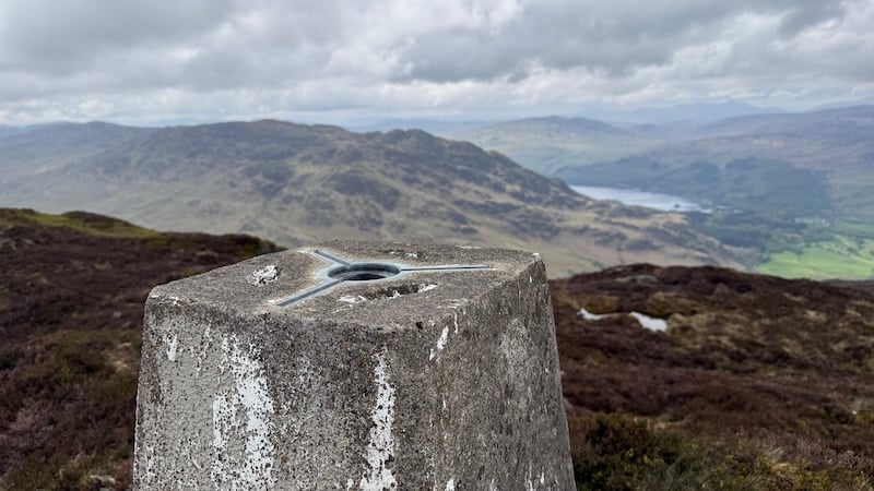
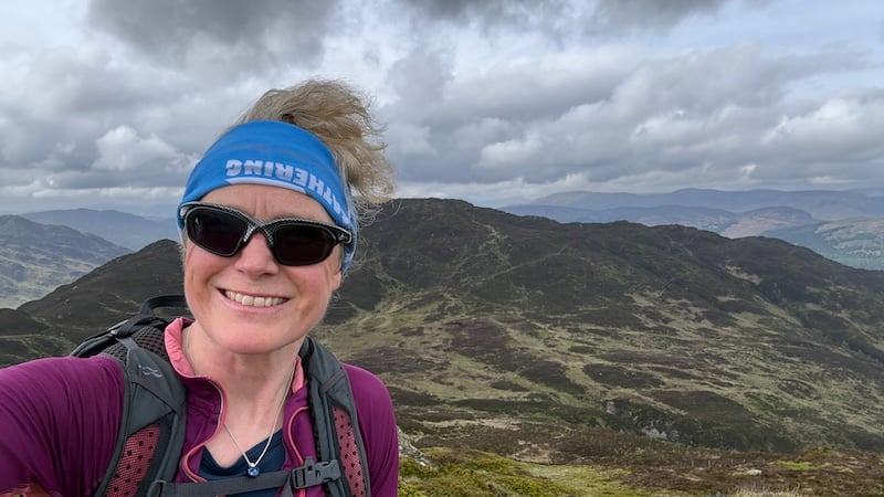
Mor Bheinn rises to the north, so I diverted in this direction and found a more obvious path for most of the next kilometre as I headed to the 640m summit. A trig sits on the top of the Fiona and I sat for a while, resting my back against the concrete pillar looking out at the landscape.
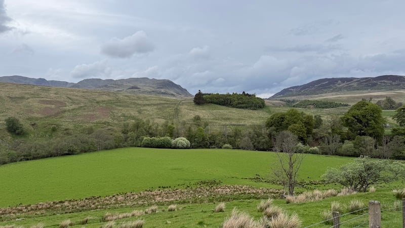
The views over surrounding mountains and down to Loch Earn were wonderful. It was also great to see the mountains I had just walked, now free of cloud.
Return route via another summit
To start my return, I retraced my steps down the Fiona and then stepped over the fence I had previously used as a handrail. Another summit, Ben Halton, has a summit just 20m shy of Mor Bheinn so I headed there for more fabulous views before starting the full descent back to the base of Glenartney.
I ended up taking a rather longer route than planned but the terrain was rough and I found myself enjoying a gentler downhill section rather than picking my way through steep ground.
This took me to the north side of a river gorge and then to a Landrover track at approximately NN731198. See my route on the linked map. (An alternative would be to head for a path southwest of a disused quarry.)
I didn’t mind the extra distance because the weather was calmer and warmer and it was a very easy track to follow. At NN718185, I turned south. I needed to get over a wall and fence, which wasn’t easy, before then tramping across a rough grazing field.
My route took me along the high edge of another river gorge, where waterfalls crashed impressively down Allt Glas.
I eventually rejoined the track I had walked earlier in the day, passing round the farm buildings, instead of walking through the (eerie) yard and then back along the road to the church car park.
I was happy that I had continued despite my early reservations and I ended up relishing the challenge and the solitude of these mountains. As is quite normal for Fionas (and Corbetts), I met not a single person while completing this route.
Note for dog owners: This full route would not be ideal if walking with a dog because of the deer fence and, in that case, I would recommend you complete the two Fionas as separate outings.
Route details: Beinn Dearg & Mor Bheinn
Distance: 21.5km
Total ascent: 1360m