
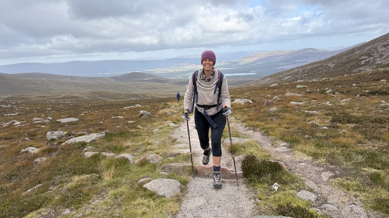
While I have walked, run and skied to Ben Macdui and Cairn Gorm on several different occasions, I am always happy to return to a great mountain route. On this occasion, it was my friend Susanna’s first tine bagging both Munros.
Ben Macdui is the second highest summit in Britain at 1309m and Cairn Gorm is the sixth highest mountain at 1245m. For reference, Ben Nevis is 1345m and the tallest mountain in Britain.
The bonus of our route to Ben Macdui and Cairn Gorm is that we started at Cairngorm Base Station car park at some 640m elevation. The total ascent for the full 18.5km route is 1142m.
You might also like to read:
Ski touring to Ben Macdui and Cairn Gorm
Walk-run: 5 of Scotland’s 4000fters
Base station to Ben Macdui plateau
There are many different ways to approach this route and some people might choose to ascend on the tourist path on Cairn Gorm before heading to Ben Macdui.
Walk Highlands also details a route to Ben Macdui ascending further west on a well-made and on to the wide ridge of Miadan Creag an Leth-choin.
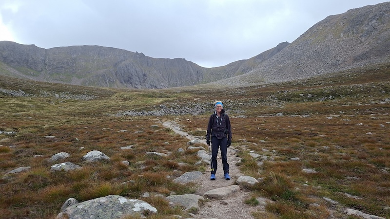
Instead, having completed both of these routes before, I decided to ascend via Coire an t-Sneachda, which is one of the famous and dramatic Northern Corries of the Cairngorms.
From the Cairngorm Mountain car park (day fee £3.50; pay on exit), Susanna and I walked to the top right, in front of the cafe and shop building, then kept right to join on an obvious path. cAfter a very short descent, the path gently ascends. We kept an eye out for a junction, early on, where we forked left.
It is easily possibly to miss this junction and continue along the base of the corries and while this isn’t the worst mistake because you can then follow the WalkHighlands route, it would mean missing out on the impressive landscape of Coire an t-Sneachda.
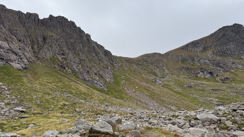
From the left fork, we progressed fairly gently uphill in a southerly, then south-easterly, direction. We enjoyed a good path and ever-expanding views ahead into the steep-faced corrie and behind us over the wider national park.
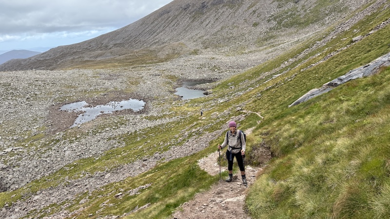
As we reached the base of the vertical corrie slopes (they are popular with climbers), we came across two lochans. The path disappeared into a jumble of rocks and boulders but it was still obvious where to go.
Our clambering led us to the east of the lochans, although a man walking near us ended up following a path to the west. It doesn’t really matter because both routes lead to the start of an obvious goat track that zig-zags up the corrie’s steep slope.
The goat path is easy to find in most places, although higher up there are a few different choices around larger crags and rocks. Taking our time, using poles for balance and thanks to careful route choice, we made quite speedy progress up the corrie wall. It was great to look back down on the corrie flor and lochans and to survey the wider sweep of the large corrie itself.
Then, suddenly, so it seemed, we found ourselves walking up over the top of the corrie and on to the much flatter plateau. Checking my watch, I saw we were at an elevation of 1100m.
Ben Macdui plateau to summit
The next stretch of the walk is a fairly gentle but long wander of some 4km across a vast sub-arctic wilderness. The environment is an exposed arctic-alpine tundra, which sounds a bit bleak but, in fact, the landscape is a beautiful, rolling tapestry of rocks, grass, lichen and moss.
The wider Cairngorms plateau is protected by multiple conservation designations and home to rare flora and fauna, some of which are sensitive to damage and disturbance by humans. It’s important to try to keep to a path and we were able to see the route stretching out ahead. In poor visibility, the plateau would be more problematic to navigate because it lacks obvious features.
Thanks to high cloud and some sunshine, Susanna and I felt fortunate to enjoy good views all around, with many other mountains to identify, including the Munros of the Braeriach traverse directly to the west and Bynack More and Bynack Beg to the east, recognisable thanks to their great tors.
As we walked, Susanna and I chatted about other walking routes we had completed in the Cairngorms, pointing out significant peaks, glens, high passes and lochs that we had previously visited. I was amazed by how much Susanna could recall from her Duke of Edinburgh gold award expedition in the area some 40 years ago. It obviously made a big impression on her and it sounded like a superb adventure for a teenager.
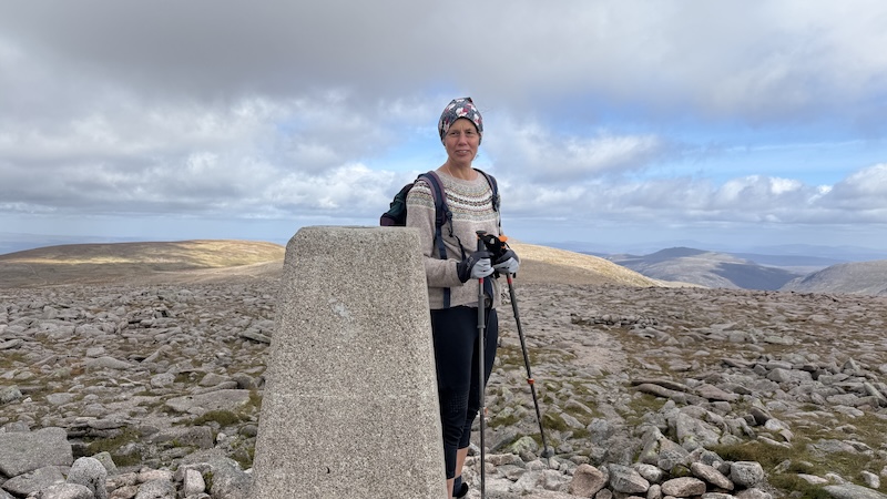
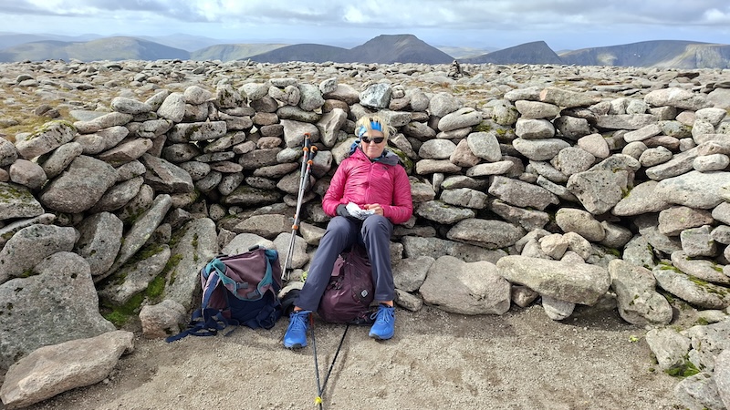
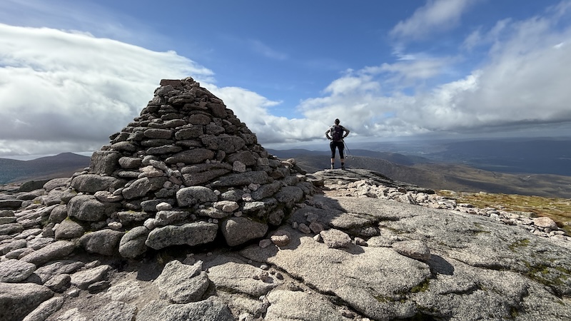
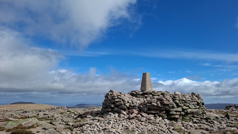
The plateau path was edged at frequent intervals by small cairns – I can’t say I am a fan of so many cairns – before a final push uphill to the trig pillar and a shelter cairn atop Macdui.
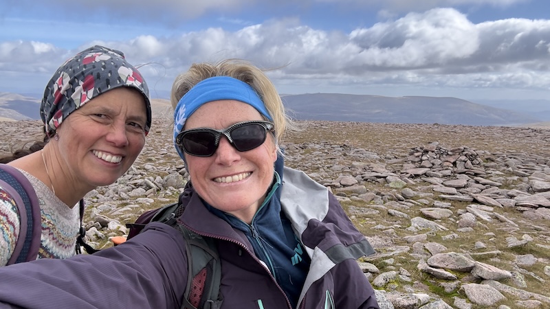
It was much windier at this elevation and Susanna and I were grateful for the shelter of the cairn, where we hunkered down to eat our lunch.
Ben Macdui to Cairn Gorm
Until the top of Ben Macdui, we had been walking with the wind mostly at our back, or side. However, when we started off again, retracing our steps north, the wind suddenly felt fiercer and colder.
It explained why everyone we had passed walking in the opposite direction as we ascended to the summit had been so wrapped up!
As is so often the case, though, the buffeting didn’t last for too long and we were soon pulling down our hoods and taking off layers once again.
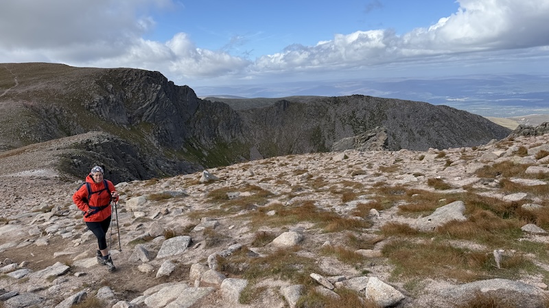
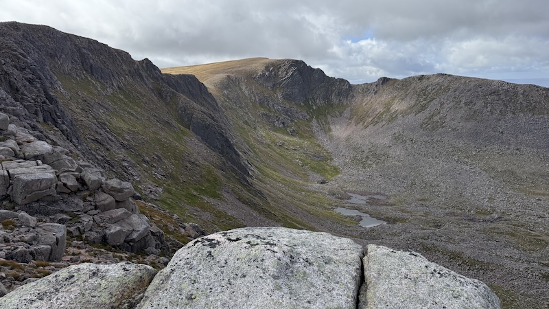
We followed the path to return to the top of the Northern Corries and then headed right (east). Our route took us along the top of the dramatic, plunging rock faces, and the further east we walked, the greater the views, which expanded behind us and along the length of the corries.
Again, the route was easy to find. The visibility was good and there was a well-defined path. Later on, just after a cairn marking a height of 1176m, we chatted to two path builders. They were employed by the national park to reinforce the route for walkers in a bid to reduce footfall across the wider plateau. We discussed current debates of the pros and cons of relaxing controlled access from the nearby Cairngorm funicular railway.
Have a read: “Trial to explore controlled summit access for funicular visitors.”
Walking on, keeping to the path, Susana and I descended for a short way to around 1099m elevation. From close to the edge of the top of the corrie walls, we had a fantastic view down into Coire an t-Sneachda, spotting the goat track we had ascended earlier in the day.
Next came, the final climb to Cairn Gorm summit, which was steeper and fairly sustained although amounted to less than 200m height gain.
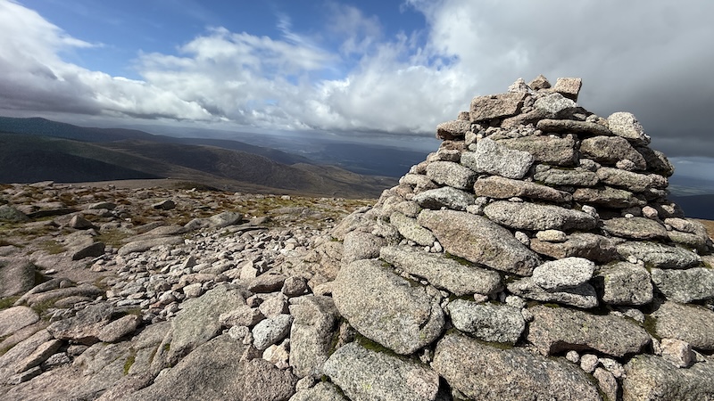
Reaching a large weather station mast first, we then walked a short way north to the true summit of Cairn Gorm and a large cairn.
It was suddenly very windy again at this exposed top and we sheltered behind the pile of rocks for the second half of our lunch.
Descent to the car park
From the summit of Cairn Gorm, the route is much more “touristy”. A very robustly built path leads north and directly downhill to the Ptarmigan station, which is part of the Cairngorm Ski Centre. There are plenty more signs of the ski centre infrastructure, including a funicular railway and ski tows.
We joined a man-made gravel path heading north and downhill from the Ptarmigan station. The rest of the walk felt a much less adventurous and remote. We shared the route with many more people and we could see the car park, now very busy with vehicles, below us.
Cairn Gorm is a relatively straightforward Munro to hike on a good weather day and it’s easy to see why it attracts many people. I would rather avoid the crowds when walking in the mountains and the slopes of Cairn Gorm felt very different to peaceful Coire an t-Sneachda and the high plateau of Ben Macdui.
Susanna and I took 5.5 hours (4.5 hours of moving time) to complete the route.
Details: Ben Macdui and Cairn Gorm, via Coire an t-Sneachda
Distance: 18.5km
Total elevation: 1142m