I returned to a Glenartney just a few days after a walk a couple of Fionas, but this time my focus was on the other side of the glen and a couple of Donalds. One of the Donalds also qualifies as a Fiona.
Before I write my walk report, let’s consider the Donalds, which are defined as “hills in Lowland Scotland that exceed 2000ft in height”. But there is more to this list and the definition than other lists, such as the Corbetts and Fionas.
It was in 1935 that Scottish Mountaineering Club member Percy Donald came up with the list. He used a rather complex formula to determine which peaks had enough prominence to be regarded as separate Donalds, and others that he regarded as Donald Tops. He was also the first to complete the hills list.
The Donald list totals 140 summits south of the line of the Highland Boundary Fault, including 89 Donald hills and 51 Donald Tops.
Donalds defined by SMC:
Donald Tops are defined as elevations in the Scottish Lowlands of at least 2000ft (610m) in height with a drop of at least 50ft (15.2m) between each elevation and any higher elevation. Further, elevations separated from higher elevations by a drop of less than 100ft (30.5m) are required to have “sufficient topographical merit”.
Donalds, or Donald Hills, are subsequently defined from Donald Tops, where a Hill is the highest Top with a separation of 17 units or less. A unit is either one twelfth of a mile along a Top’s connecting ridge or 50ft (30.5m) in elevation between the Top and its connecting bealach/col. The separation is the sum of these two measures.
Fionas, Grahams and Corbetts can also be Donalds
There is a crossover with other lists, such as a Fionas (Grahams) and Corbetts but remember they need to be in lowland Scotland. Fionas are hills that rise to a height of between 2000ft and 2500ft and also have a minimum drop of 150m of separation on all sides. There are more than 20 Fionas that are also Donalds.
There are also seven Corbetts that are also Donalds, because Percy Donald did not set an upper height limit for his list. Corbetts are Scottish mountains of between 2500ft and 3000ft height and with a prominence of at least 500ft (152m).
The two most northerly Donalds, which I walked on this occasion, are Beinn nan Eun and Uamh Bheag. The former only joined the list in 1994 after careful examination of the route of the Highland Boundary Fault line revealed it to be in the Scottish Lowlands and therefore a Donald. Meanwhile, Uamh Bheag is listed as both a Donald and a Fiona, while the prominence of the other Donald, Beinn nan Eun, is not sufficient to make it a Fiona.
Added to this, I also bagged to nearby Donald Tops, Beinn Odhar and Meall Clachach.
Right, so now we have that clear, let me tell you more about the route I took to reach the four summits.
Glenartney: 2 Donalds and 2 Donald Tops
In contrast to the previous trip to Glenartnery, which started with cloud and drizzle, my second outing featured warm sunshine, although still quite windy at higher elevation.
I parked in Glenartney Church car park again and also walked east along the road, but this time I turned almost immediately right on to a track.
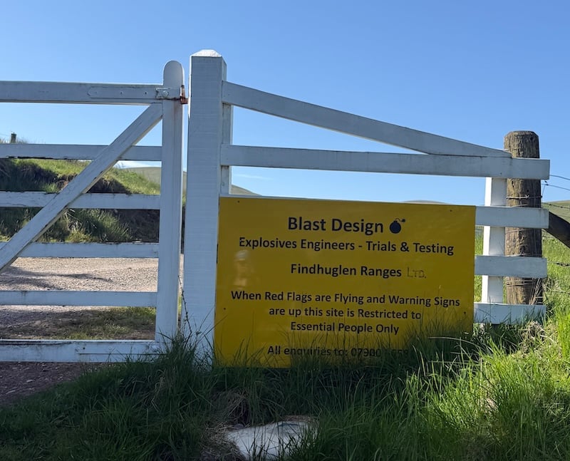
There is a gate at the start of the track with a large yellow sign warning of explosives testing. Apparently, red flags are flown when there is a potential danger and this means the area is restricted. I have no idea how frequently this occurs but thankfully there were no explosive experiments on-going when I was visiting.
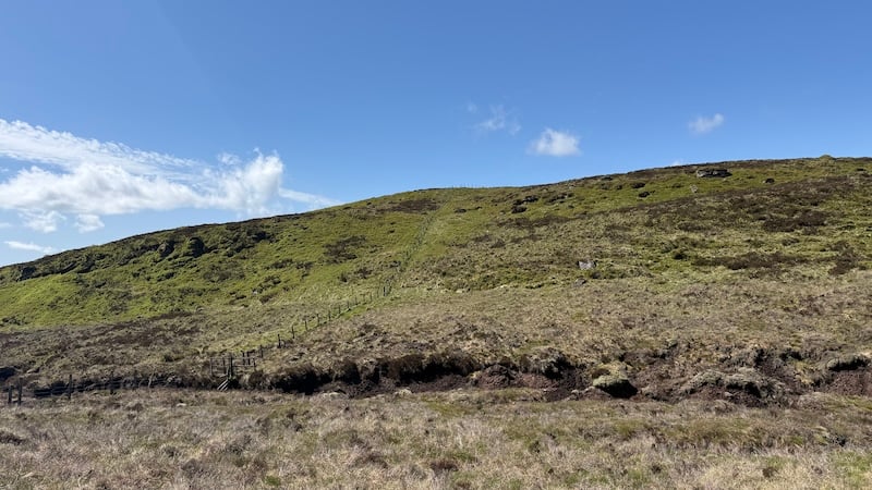
After passing through the gate, I walked on a wide track for a few hundred metres and then passed through another two metal gates before crossing a bridge over Findhuglen Water. From here, I started the ascent of Beinn nan Eun, south-easterly, on rough ground. I had been hoping for some kind of path or trod but instead I found myself tramping across ground thick with grassy tussocks and heather.
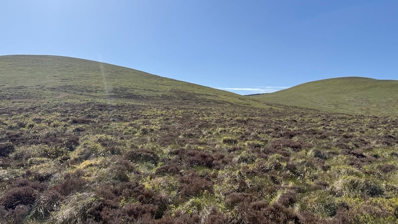
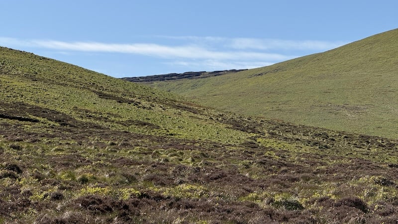
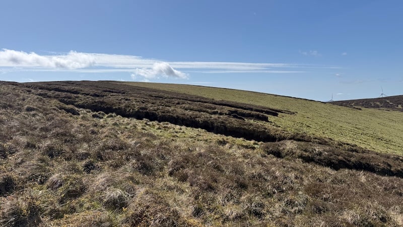
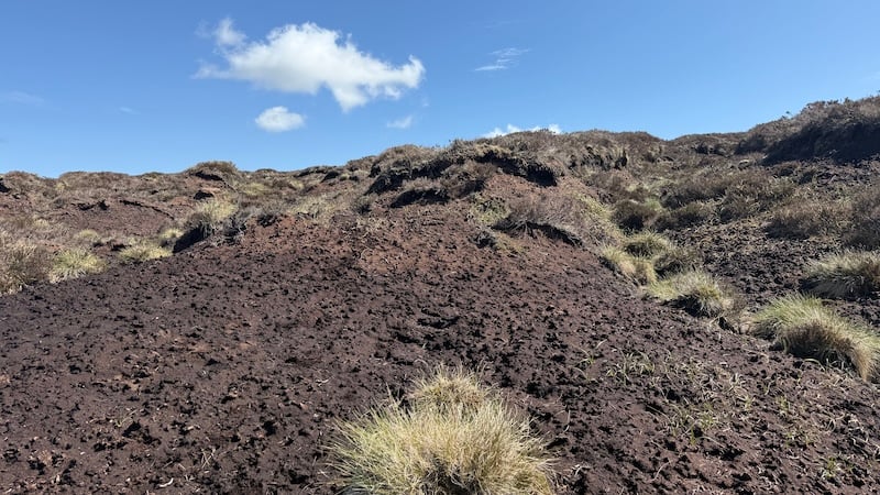
I had previously read about a vast network of huge peat hags so I felt grateful that the terrain at this stage was “only” tussocky. The gradient steepened for a while until around 500m elevation when I was then faced with the monster peat hags. They covered a large area on the upper reaches of Beinn nan Eun, forming deep muddy troughs and high grassy tops.
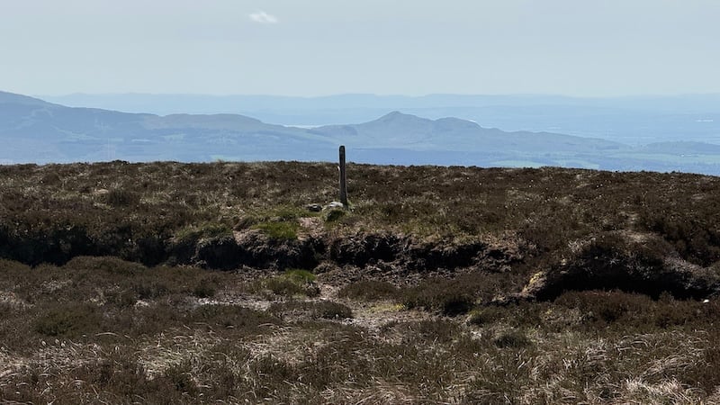
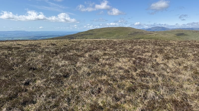
I managed to find a way around the area, tracking to the west and then approaching the summit from this side. The 631m top was marked with a small wooden post. It felt somewhat uneventful but I stopped for a while to eat a snack and to take in the expansive views of many Perthshire peaks.
I was also aware that there were many more peat hags to come. I had spotted the obvious outline of the trenches from afar, which revealed they were going to be large and deep.
A Donald Top, Beinn Odhar came next and I confess I wasn’t exactly sure where the 626m summit was. There was no significant cairn to be found, so I wandered around on the round, heathery summit for a while and guessed I had walked over the highest point while doing this.
I can recall my friend Ben telling me that there are many Donalds with indistinct summits, when we walked his last Donald several years ago. Also read: Ben’s article about what he learned while walking the Donalds.
On to Uamh Bheag – and even more peat hags
The size and depth/height of the peat has on the next section became almost comical. I decided it was better to laugh than to cry and I settled into a game of trying to find the best peat troughs through the network of hags. Sometimes I found a trough running in exactly the right direction, while at other times I needed to heft myself up at the side of a tall peat hag wall and over the top only to descend, while sitting down, into another trough.
Walking generally south-westerly, my aim was a fence line in the distance, which I could see on the map would take me straight up to the summit of Uamh Bheag.
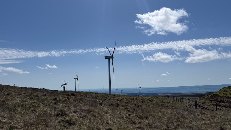
I was also met with the tall windmills of a windfarm and I could see access roads spread out below me and to the south. I imagine that these rough roads could offer a reasonable alternative approach to the Donald.
At the fence, I started the ascent of Uamh Bheag. Staying close to the fence line offered the easiest ground and I noticed a trod had developed. The rest of the route was completed on a fair amount of trod or path.
As I took my time to head uphill, I spotted, in the distance, someone coming downhill. It is rare to meet other people on the Donalds and Fionas, so I was keen to say hello.
The man was running fast downhill but he seemed happy to stop for a chat. It turned out that Ben van Dijk was part of the Munro Relay that had set a new record the week before. Further conversation revealed his dad was the brother of a friend from my school days in Peebles. What a small world!
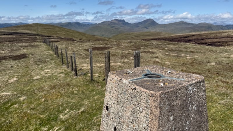
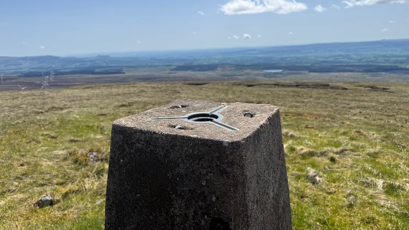
Ben had cycled to the hill via the windfarm roads and had already been to the summit. We said goodbye and as he continued his descent, I pushed on uphill. This time the 666m top was clearly marked with a fine concrete trig pillar.
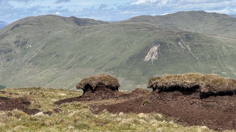
From the top, I followed a fence line north and took a short diversion west to pick up another Donald Top, Meall Clachach at 619m, before a gentle descent, in a northerly direction, over the shoulder of Am Beannan. There were more oddly shaped peat hags but it was easy enough to divert around them.
Looking at the map, I knew I needed to avoid some steep crags to the east, so I tracked west for a while (I was maybe over cautious in my circuit west but I would rather not find myself at the top of a steep section, especially while walking solo).
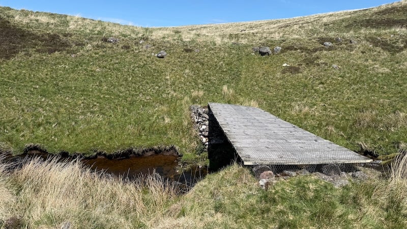
I picked up a trod again and aimed downhill to the north-east and in the direction of a bridge over a fast-flowing burn lower down the slope. As it turned out, the river was passable at various sections by using large rocks as footsteps but, in the end, I chose to cross the bridge.
By using the bridge, I came across a path that took me further downhill and alongside the burn. I tried to stick to the path but it was intersected by many animal trods and, at times, I wasn’t sure if I was on a well-trodden path or an animal trod.
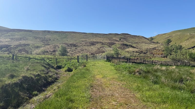
Eventually, I concluded the best path would be on the south shore of the burn, which I did find. I followed this, climbing over a fallen tree at one point, until I reached a metal gate that brought out on to the singletrack road that journeys through Glenartnery.
The final section of the walk was on tarmac, heading east, and back to the car park.
This is a fine circuit and while there is some challenging terrain, the rewards are great views and four bagged summits.
Route details: Beinn nan Eun and Uamh Bheag
Distance: 15km
Total ascent: 800m